Centre Uses Drones in a major step toward modernizing land records in India, the central government has undertaken an ambitious initiative to use drone technology to survey approximately 67,000 square kilometers of land spanning over 3 lakh villages. This project is part of the ‘SVAMITVA’ (Survey of Villages and Mapping with Improvised Technology in Village Areas) scheme launched in 2020 by the Ministry of Panchayati Raj in collaboration with the Survey of India. The effort aims to provide rural residents with digital property cards, streamline land records, and bring clarity and transparency to land ownership, disputes, and development planning.
The use of cutting-edge drone technology for mapping and surveying is seen as a revolutionary step in India’s governance and administration. By applying advanced geospatial techniques, the project addresses many challenges associated with traditional land survey methods, including unclear boundaries, Centre Uses Drones lack of property documentation, and disputes over ownership. The large-scale use of drones signifies a paradigm shift in how the government handles land records management and aims to empower rural citizens through digital inclusion.
This article examines the scope of the initiative, its potential impact, the advantages of drone technology for land surveys, challenges faced, and the larger implications for rural development and governance.
SVAMITVA Scheme: Transforming India’s Land Records
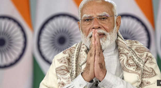
The SVAMITVA scheme, launched by Prime Minister Narendra Modi in April 2020, aims to create a comprehensive record of land ownership in rural India. The survey being carried out with the help of drones is integral to this scheme and has emerged as a game-changer in land records modernization.
Traditionally, India’s land records have been plagued with issues like outdated cadastral maps, Centre Uses Drones unclear property titles, and overlapping claims. The lack of accurate data has often led to litigation, fraudulent land transactions, and developmental bottlenecks. With SVAMITVA, the government seeks to rectify these challenges by implementing a scientific method of property mapping and providing clarity to millions of landholders.
Scope of the Project
The survey currently covers 67,000 sq km of land area distributed across more than 3 lakh villages throughout the country. It includes measuring the boundaries of rural residential properties using drones equipped with highly accurate cameras and geospatial mapping capabilities.
Here are some of the major highlights of the survey:
- Property Cards: Upon the completion of the drone survey, property owners in the villages will receive property cards that serve as legal documentation of ownership. These cards are digitally stored and authenticated.
- Digital Mapping: The data collected is integrated with Geographic Information System (GIS) technology to create highly detailed digital maps of rural areas.
- Resolving Boundary Issues: Clear demarcation of property and village boundaries is one of the primary goals, addressing years of disputes and uncertainties.
- Integration with Panchayat Records: The data generated from these surveys will be incorporated into the Panchayat-level systems, helping local governments in resource allocation and developmental planning.
- Focus on Inclusivity: All villages, regardless of their location and size, Centre Uses Drones are being covered systematically, with priority given to rural and remote areas that previously lacked robust documentation.
 For the more information click on this link
Why Drones for Land Surveys?
The use of drone technology is a crucial innovation in this initiative, Centre Uses Drones allowing the government to overcome several challenges associated with traditional surveying methods.
- Precision and Accuracy: Drones equipped with advanced cameras and GPS mapping systems provide highly accurate and detailed imagery. This eliminates errors often seen in manual surveys conducted with outdated equipment.
- Faster Data Collection: Conventional land surveying methods are slow and labor-intensive, often taking years to cover extensive areas. Drones, by contrast, can map large swaths of land in a matter of days or weeks.
- Reduced Costs: While the upfront cost of drones and technology may appear high, Centre Uses Drones they drastically reduce the long-term expense associated with human resources, land disputes, and manual recalibration.
- Accessible to Remote Areas: Drones can survey terrains that are inaccessible or difficult for manual surveys, including hilly regions, dense forests, or flood-prone areas.
- Integration with Digital Systems: The imagery and data captured by drones can be immediately processed and uploaded to digital systems, enabling real-time monitoring and integration into GIS platforms.
Achievements So Far
The drone surveys conducted as part of the SVAMITVA scheme have already shown promising results:
- Over 9 crore rural property owners have received or are in the process of receiving property cards based on drone surveys.
- Villages that historically faced multiple land disputes are reporting fewer disagreements due to better clarity in land demarcation.
- Digitized maps of several thousand villages have been created, Centre Uses Drones ensuring better transparency and ease of governance.
- Local governments, including Gram Panchayats, are utilizing this data to plan infrastructure projects like roads, drainage systems, and public facilities more efficiently.
Advantages of the Survey
The use of drones and digital mapping systems under the SVAMITVA scheme has a wide array of benefits for rural governance, the economy, and individuals:
- Eliminating Land Disputes: Rural areas are rife with property disputes due to unclear boundaries. The survey provides scientific and legal documentation of land, minimizing conflicts and the scope for fraud.
- Legal Empowerment: Property cards provided under this scheme give landowners formal recognition of their property rights. This enables them to leverage their property to access bank loans or conduct legal transactions.
- Improved Governance: Clear property records streamline governance at the village level by aiding better decision-making, especially in infrastructure planning, taxation, Centre Uses Drones and disaster management.
- Ease of Lending: The formalization of property titles will help landholders use their property as collateral, enabling better access to credit from financial institutions.
- Revenue Generation for Panchayats: Digitally mapped land records will enable local governments to collect property taxes more efficiently, leading to increased revenue for rural development.
- Reduction in Corruption: By digitizing land records and making them accessible online, the government ensures transparency, reducing opportunities for corruption and manipulation in land registration offices.
- Economic Boost: Clear and reliable property records encourage investments and transactions, Centre Uses Drones creating an enabling environment for rural economic growth.
Challenges and Concerns
While the use of drones for land surveys is revolutionary, the initiative does not come without its challenges and areas of concern:
- Resistance from Villages: In some areas, villagers have resisted the surveys, Centre Uses Drones fearing misuse of data, displacement, or changes in taxation policies. Building trust among rural populations remains a key challenge.
- Technical Barriers: The operation of drones and integration of data with GIS systems require trained personnel and advanced technology, which can be limited in certain regions.
- Infrastructure Bottlenecks: In remote areas, poor internet connectivity and lack of adequate infrastructure hinder the seamless implementation of digital land record systems.
- Data Security and Privacy: With sensitive information being collected, Centre Uses Drones there are growing concerns about the security and misuse of data. Ensuring that property data is stored and utilized responsibly is critical.
- Logistics of Scale: Surveying over 3 lakh villages is a mammoth task, Centre Uses Drones and the logistics involved — from deploying drones to processing data — are complex and resource-intensive.
Steps Taken to Address Challenges
The central government, along with state and local authorities, Centre Uses Drones has introduced measures to tackle these challenges:
- Awareness Campaigns: Local officials are conducting campaigns to educate villagers about the benefits of the survey and dispel myths regarding land acquisition or increased taxation.
- Training Personnel: The government has partnered with the Survey of India to train drone operators and GIS experts to handle the technical aspects of the project.
- Building Infrastructure: Investments in rural internet connectivity and digital infrastructure are being made to support the integration of land data into online platforms.
- Policy Framework: Laws and policies are being developed to ensure data privacy, Centre Uses Drones Centre Uses Drones secure storage, and responsible use of land records to build trust in the system.
 For the more information click on this link
Implications for Rural Development
The drone-based land survey is expected to have transformative effects on rural India:
- Enhanced Livelihoods: By ensuring ownership rights and providing formal documentation, Centre Uses Drones the initiative can unlock new economic opportunities for landholders.
- Rural Industrialization: With clearer land records, rural areas can attract investments in industrial, educational, and healthcare facilities.
- Streamlined Public Services: Government programs related to housing, irrigation, and welfare can be implemented more effectively when accurate land records are available.
- Financial Inclusion: Access to loans and credit, facilitated by property cards, Centre Uses Drones could empower rural residents to invest in education, entrepreneurship, Centre Uses Drones and agriculture.
Conclusion: A Modernization Milestone
The use of drones to survey 67,000 square kilometers of land across 3 lakh villages under the SVAMITVA scheme represents a milestone in India’s journey toward modernizing land records and improving rural governance. By leveraging drone technology, Centre Uses Drones the government is addressing decades-old challenges in land management, creating a framework for a more equitable, transparent, Centre Uses Drones and prosperous rural India.
As the project moves forward, its success depends on sustained collaboration between the central government, local administrations, and rural communities. With accurate land records at its core, Centre Uses Drones this initiative is not just about mapping territory — it is about empowering millions of Indians, Centre Uses Drones enhancing rural livelihoods, and fostering sustainable development. The widespread implementation of this technology is likely to serve as a model for other countries grappling with land governance challenges, placing India at the forefront of innovation in public administration. ALSO READ:- Gaza Ceasefire and Hostage Release Set to Begin; Israeli Troops Start Withdrawing from Rafah 2025


